
In Owatonna, the line connected to the Minnesota Central Line towards the Twin Cities. The same year, the route continued through Cresco, meeting an existing route at Calmar, Iowa by the end of the year.
The line primarely served as a connecting line between Austin and an existing mainline at Calmar. The same year, the route became part of the Milwaukee & St. Paul Railway.
By 1874, the Milwaukee & St. Paul became the Chicago, Milwaukee & St. Paul Railway, commonly known as the Milwaukee Road.
During the early years of the 20th Century, the Milwaukee Road greatly upgraded routes, and built a new mainline to the Pacific Ocean at Seattle. An expensive route, this extension sent the Milwaukee Road into financial turmoil.
By 1925, the Milwaukee Road had declared bankruptcy and reorganized as the Chicago, Milwaukee, St. Paul & Pacific Railroad in 1928.
This line saw little change throughout the years. While the Milwaukee Road saw success in the post-WWII years, the Midwest was heavily overbuilt with numerous railroads. As a result, the Milwaukee Road again entered bankruptcy in 1974, and begun significantly trimming route mileage.
The Pacific extension was formally abandoned west of Miles City, Montana in 1980; and numerous other routes were abandoned between 1980 and 1982.
In 1985, the Soo Line Railroad purchased the struggling Milwaukee Road. On January 1st, 1986; the Milwaukee Road ceased to exist, completely merging into Soo Line.
As a continuing effort to cull excess lines, the entire Austin-Calmar route was abandoned in 1983. The Minnesota DNR initially purchased the right-of-way between Rose Creek and Adams for the Shooting Star State Trail. While the remaining Austin-LeRoy segments are abandoned, the trail now runs roughly parallel through the entire length. In Iowa, a short trail from Calmar to Cresco also uses the former railroad grade.
In 1985, the Soo Line Railroad purchased the struggling Milwaukee Road, including the Austin-Owatonna segment of this line. On January 1st, 1986; the Milwaukee Road ceased to exist, completely merging into Soo Line.
The Soo Line had been a part of the Canadian Pacific Railway system since 1984, when they purchased Soo as a subsidiary. CP continued operations of the Mason City-Austin route under the Soo Line name, until April of 1997, when it sold nearly 1,400 miles of trackage to I&M Rail Link.
By 2002, the routes owned by I&M were transferred to Iowa, Chicago & Eastern Railroad, a subsidiary of Dakota, Minnesota & Eastern. DM&E and IC&E were purchased by Canadian Pacific Railway in October 2008.
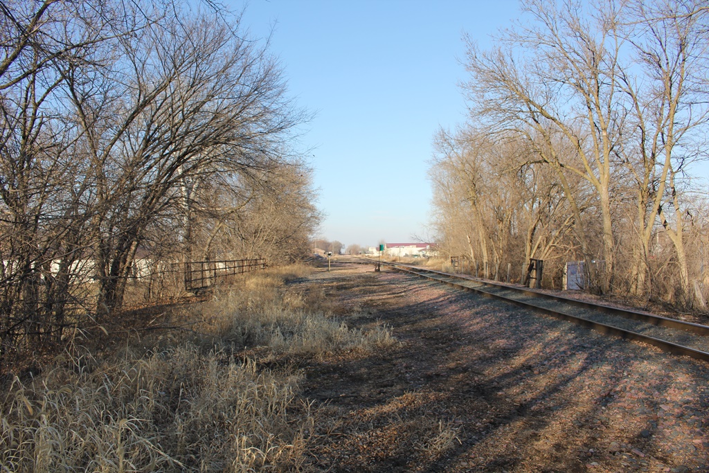
Today, CP continues to operate this route as subsidiary Dakota, Minnesota & Eastern. It is known as the Owatonna Subdivision, seeing approximately four trains per day.
06/26/21
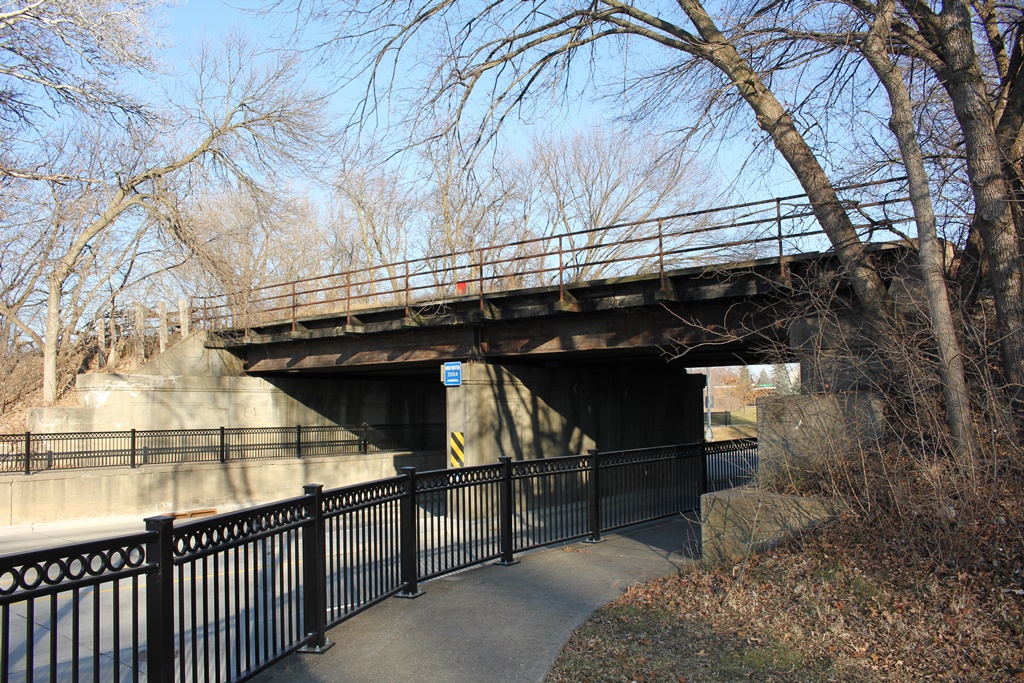
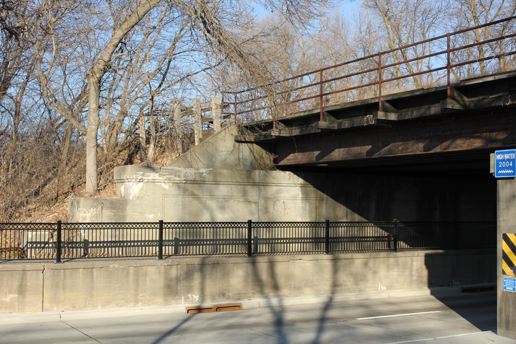
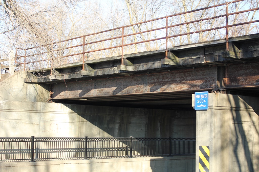
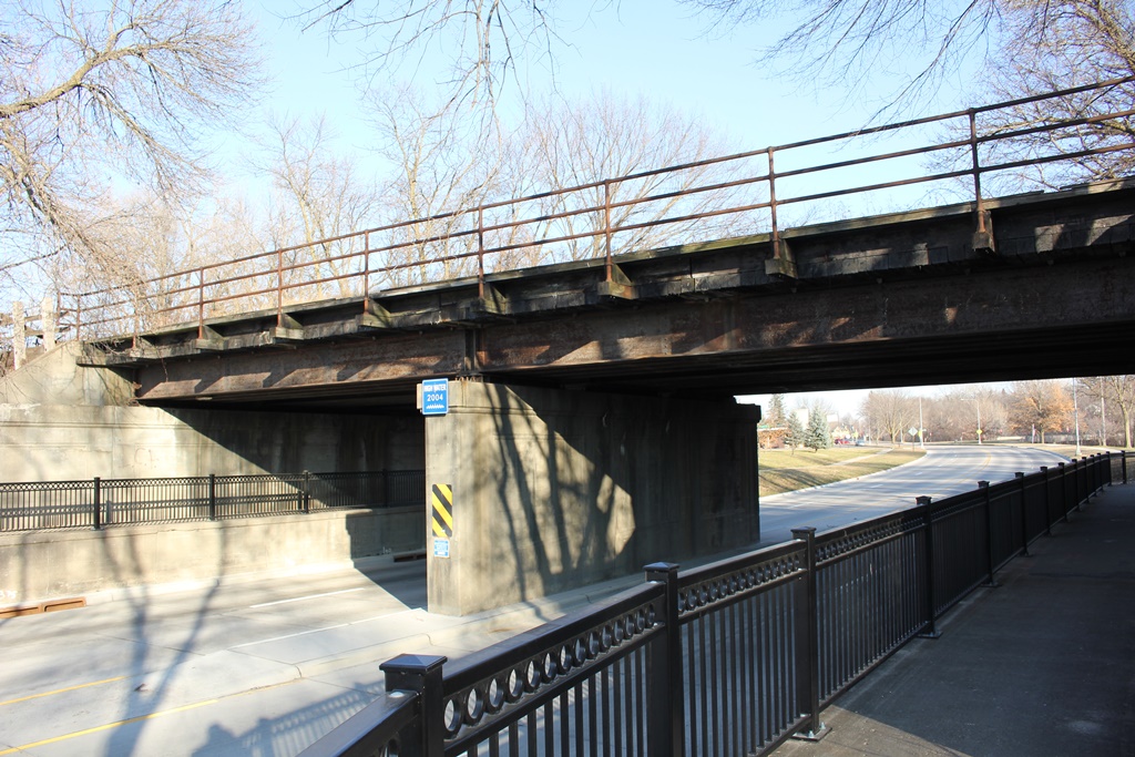
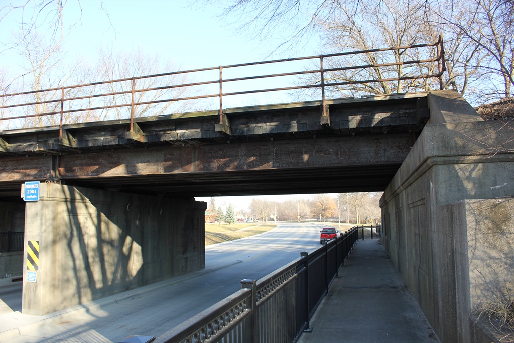
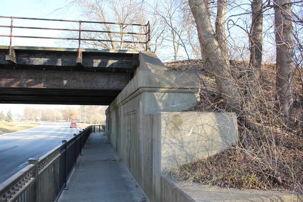
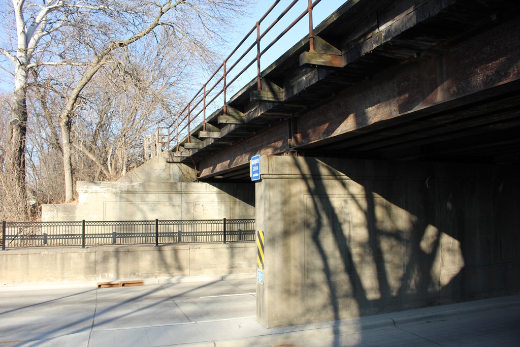
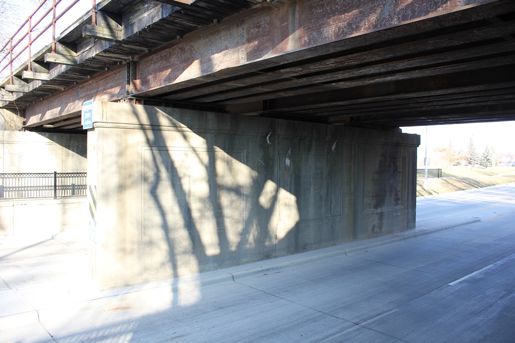
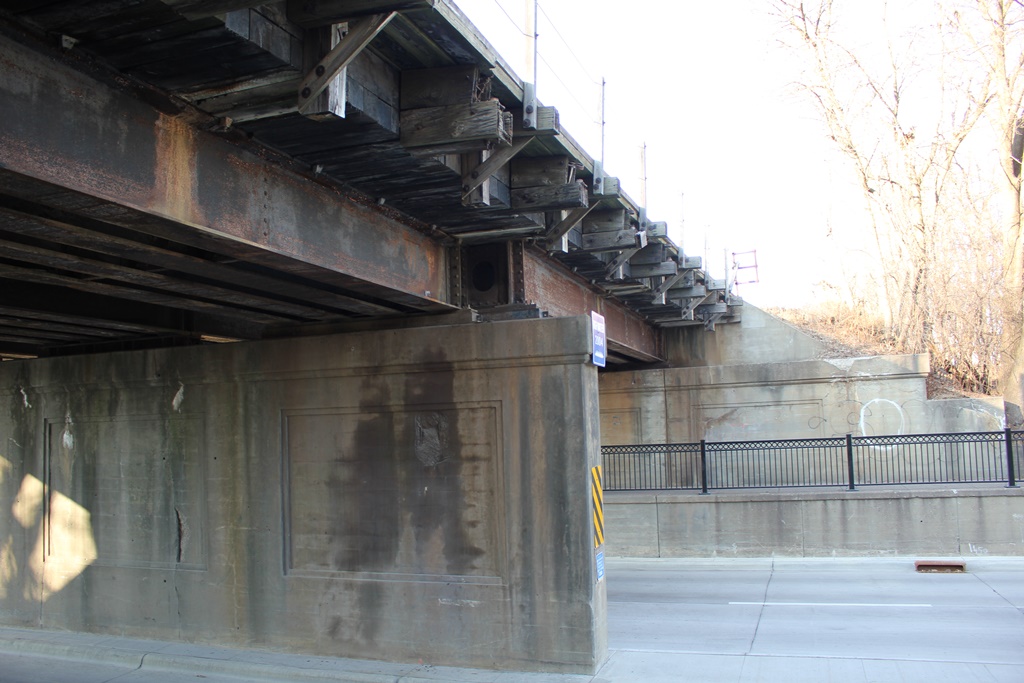
Located between 10th and 11th Streets in Austin, this steel stringer bridge crosses Oakland Place (formerly US Highways 16 and 218).
Built in 1934, this was one of the first significant improvements along the rural US Highway System in Minnesota. Originally, US-16 ran between US-20 and US-14 at Yellowstone National Park and US-10 and US-12 in Detroit, Michigan.
In 1962, US-16 was decommissioned in Michigan, having been replaced by I-96. After I-90 through South Dakota, Minnesota and Wisconsin was completed in 1978, US-16 was completely removed from maps in 1980.
The segment through Austin was one of the first divided and "modern" segments of any US Highway in the United States. A number of grade separations were built, including two now demolished concrete frame bridges at 2nd Street and the Chicago Great Western Railroad (now 3rd Street).
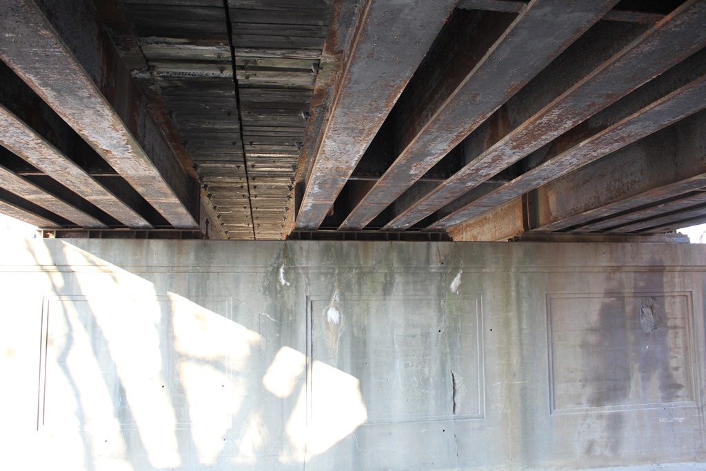
The bridge here consists of a two span steel stringer, featuring a ballasted deck and concrete substructures. A sign near the top of the bridge indicates the high water mark from Dobbins Creek and the Cedar River in 2004.
Surprisingly, this bridge features limited decorative features, and appears to be purely functional.
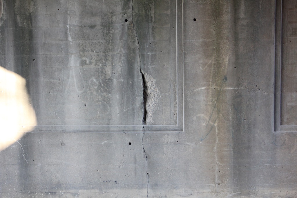
Overall, the bridge appears to be in fair to good condition, with no significant deterioration.
The author has ranked this bridge as being locally significant, due to the common design.
The photo above is an overview.